


AVAILABLE EVERYWHERE (Call for info)

LINKS:


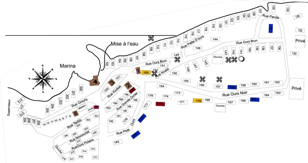
SITE MAP - Les Deux Ours
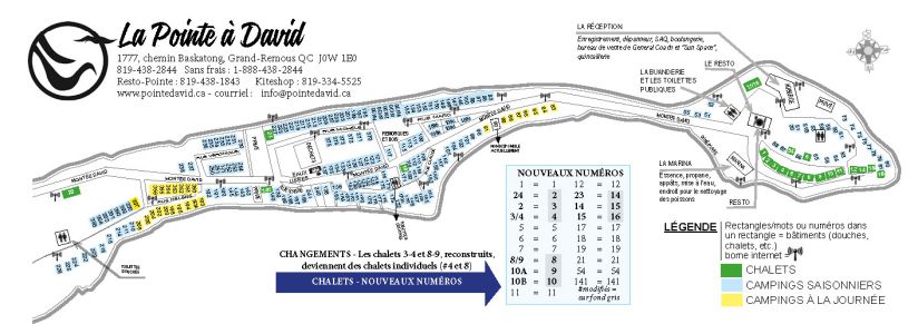
SITE MAP - La Pointe à David

FRANÇAIS


© ALL RIGHTS RESERVED Conception DC
CLICK TO ENLARGE
BASKATONG LAKE
The Baskatong Reservoir was formed during the construction of the Mercier Dam in 1927.
")

Some facts about the reservoir
• Surface Area: 320km2
• Depth: 96 meters
• Circumference: 1800km
• 2800 km of Shoreline with incredible beaches
• Over 160 Islands
• Since 1998 Baskatong Reservoir is a Community Wildlife Conservation Area
(Fishing rights are compulsory)
• Renowned for its sandy beaches
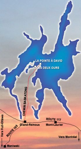

Come visite us: it's easy!
Paved road.
From the South - Ottawa / Gatineau / Maniwaki :
Take Highway 105 north to the 117 Junction in Grand-Remous. Turn Right on Highway 117. Turn Left on chemin Reservoir Baskatong. La Pointe à David is
29 Kilometers from Highway 117. DISTANCE FROM OTTAWA :
190 KM
From the Southeast - Montréal / Mont-Laurier :
Take Highway 117 North to Grand-Remous. In Grand-Remous turn right on chemin Reservoir Baskatong. La Pointe à David is 29 Kilometers from Highway 117.
DISTANCE FROM MONTREAL: 290 KM.
FOLLOW THE SIGNS!
From the Northwest -
Val d'Or :
Take Highway 117 South
to Grand-Remous.
Turn Left on chemin
Reservoir Baskatong.
La Pointe à David is
29 kilometers from
Highway 117.

...THE OUTFITTER PAR EXCELLENCE